THE PICTURE OF LIFE

THE PICTURE OF LIFE

THE PICTURE OF LIFE

THE PICTURE OF LIFE

THE PICTURE OF LIFE

Monday, February 29, 2016

Yosemite falls , USA


Yosemite Falls is the highest waterfall in Yosemite National Park, dropping a total of 2,425 feet (739 m) from the top of the upper fall to the base of the lower fall. Located in the Sierra Nevada of California, it is a major attraction in the park, especially in late spring when the water flow is at its peak.

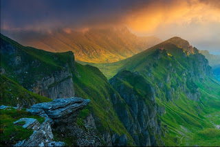
Piatra Craiului National Park , Romania


Piatra Craiului Natural Park features the longest and highest limestone ridge in the country (over 15 miles long and 6560 ft. high). Bordered by glacial lakes, the ridge is regarded as one of the most beautiful sights in the Carpathians. The two-day north–south ridge trail is both challenging and rewarding. Starting at either Plaiul Foii in the northwest orCurmatura in the northeast, hikers climb up to the ridge along the narrow spine of the range. The descent at the southern end leads into a karst landscape of deep gorges and pitted slopes where water penetrating the rock has carved a series of caves.
The traditional villages of Magura, Pestera, Ciocanu, Sirnea, make for interesting starting points for the routes on the eastern slope and for getting in touch with the traditional Romanian way of life.

Lake Saifulmuluk , Naran, Pakistan


Lake Saiful Muluk is located in the high mountain ranges of the Karakorum and rests at the northern end of the Kaghan Valley. It is in the north east of the Mansehra District of the Khyber.
Pakhtunkhwa Province and is approximately 14 Kilometers from Naran. At an altitude of 3,224 m
(10,578 feet) above sea level, it is amongst one of the highest lakes in Pakistan. 

The water is very clear with a slight green color to it. The clarity of the water comes from the multiple glaciers of the Malka Parbat surrounding the high basin which feed the lake. Lake Saiful Muluk is considered to be one of the most beautiful lakes in Pakistan. The weather at the lake is moderate during daytime and drops below 0 degrees celsius at night. The lake is accessible by a 14 km road from Naran during the summer months. On foot, the hike from Naran to the lake takes from 3 to 6 hours.

Shanghai , China


Shanghai is the largest Chinese city by population and the largest city proper by population in the world. It is one of the four direct-controlled municipalities of China, with a population of more than 24 million as of 2014. It is a global financial center,and a transport hub with the world's busiest container port.Located in the Yangtze River Delta in East China, Shanghai sits on the south edge of the mouth of the Yangtze in the middle portion of the Chinese coast. The municipality borders the provinces of Jiangsu and Zhejiang to the north, south and west, and is bounded to the east by the East China Sea.

For centuries a major administrative, shipping, and trading town, Shanghai grew in importance in the 19th century due to European recognition of its favorable port location and economic potential. The city was one of five forced open to foreign trade following the British victory over China in the First Opium War while the subsequent 1842 Treaty of Nanking and 1844 Treaty of Whampoa allowed the establishment of the Shanghai International Settlement and the French Concession. The city then flourished as a center of commerce between east and west, and became the undisputed financial hub of the Asia Pacific in the 1930s. However, with the Communist Party takeover of the mainland in 1949, trade was reoriented to focus on socialist countries, and the city's global influence declined. In the 1990s, the economic reforms introduced by Deng Xiaoping resulted in an intense re-development of the city, aiding the return of finance and foreign investment to the city.

Shanghai is a popular tourist destination renowned for its historical landmarks such as The Bund, City God Temple and Yu Garden as well as the extensive Lujiazui skyline, many skyscrapers, and major museums including the Shanghai Museum and the China Art Museum. It has been described as the "showpiece" of the booming economy of mainland China.

Sunday, February 28, 2016

Hokkaido , Japan


Hokkaido , formerly known as Ezo, Yezo, Yeso, or Yesso, is the 2nd largest island of Japan, and the largest and northernmost prefecture. The Tsugaru Strait separates Hokkaido from Honshu, although the two islands are connected by the underwater railway Seikan Tunnel. The largest city on Hokkaido is its capital, Sapporo, which is also its only ordinance-designated city.

The island of Hokkaido is located at the north end of Japan, near Russia, and has coastlines on the Sea of Japan, the Sea of Okhotsk[əuˈkɔtsk], and the Pacific Ocean. The center of the island has a number of mountains and volcanic plateaus, and there are coastal plains in all directions. Major cities include Sapporo and Asahikawa in the central region and the port of Hakodate facing Honshu.

The governmental jurisdiction of Hokkaido incorporates several smaller islands, including Rishiri, Okushiri Island, and Rebun. (By Japanese reckoning, Hokkaido also incorporates several of the Kuril Islands.) Because the prefectural status of Hokkaido is denoted by the dō in its name, it is rarely referred to as "Hokkaido Prefecture", except when necessary to distinguish the governmental entity from the island.

The island ranks 21st in the world by area. It is 3.6% smaller than the island of Ireland while Hispaniola is 6.1% smaller than Hokkaido. By population it ranks 20th, between Ireland and Sicily. Hokkaido's population is 4.7% less than that of the island of Ireland, and Sicily's is 12% lower than Hokkaido's.

In the east, there are two areas (surrounding, for example, Shari and the Nakashibetsu Airport) where a grid with spacing of nearly 3 km is formed by narrow bands of forest.[citation needed] It was designed to buffer wind, especially during blizzards, to protect cattle. It also serves as habitat and transportation corridors for animals and hikers.

Alftafjordur , Iceland


Alftafjordur, Fjord located near Dvergasteinn which is a town in Iceland, a country on the continent of Europe.

Rhone Valley , France


The Rhone Valley is a key wine-producing region in the south-east of France. It follows the north–south course of the Rhone river for almost 150 miles (240km) from Lyon to the Rhone Delta (the Bouches-du-Rhône), near the Mediterranean coast.

The length of the valley means that Rhone wines are the product of a wide variety of soil types and mesoclimates. The region's wine-producing areas cover such a distance that there is a widely accepted division between its northern and southern parts. Rather neatly, they are separated by a gap of 25 miles (40 km) between the towns of Valance and Montelimar, in which almost no vines are grown.

Rhone
The Hermitage chapel, overlooking the Rhone
This division is reflected not only in geography and preferred grape varieties, but also in the quality and quantity of wines produced. The smaller, more quality-driven northern section focuses almost entirely on Syrah for red wines and Viognier, Marsanne and Roussanne for whites, while the larger and more prolific south employs a much longer list of varieties. The most notable of these are the red varieties Grenache and Mourvedre, which are combined with Syrah to produce the 'GSM' blend so characteristic of the southern Rhone. While the granite-blessed slopes of the north are paired with a continental climate, the rocky, sandy soils of the flatter south enjoy the warmer winters of a Mediterranean climate.

Prestige is also a key differentiator between the northern and southern areas of the Rhone. The north boasts old and highly respected names, such as Hermitage and Cote Rotie, but it accounts for only 5% of the valley's total wine production. The remaining 95% is made in the south under less-prestigious, less-specific names. The south is not entirely lacking in prestige, however, as it is here that the Chateauneuf-du-Pape appellation is located.

One important, unifying constant between the two areas is the regional Cotes du Rhone appellation, which can be claimed by red, rosé and white wines from all over the valley. This title covers 171 communes over the 125 miles (200km) between Vienne in the north and Avignon in the south – the towns that mark the beginning and end of the main valley. These wines are still subject to the rules and regulations of the appellation laws, but do not match up to the quality required from more location-specific titles such as Saint-Joseph or Gigondas. 

The appellation Cotes du Rhone Villages is restricted to specific villages whose terroir produces wine of a slightly higher quality. By chance, they are clustered in the southern section of the Rhone valley, around the town of Orange. An elected sub-set of about 20 (this list changes over time) are permitted to add their village names to the title Cotes du Rhone Villages, producing some interesting, long-winded names such as Cotes du Rhone Villages Saint-Maurice-sur-Eygues.

One small but important area not covered by the obvious north/south divide is the Die district to the east of the Rhone. Located 30 miles (50km) east of Valence and Montelimar, the ancient town of Die sits at the foot of the French Alps. It produces sparkling wines under the appellations Clairette de Die and Cremant de Die, as well as some still whites under the Coteaux de Die title.

Oregon , USA


Oregon  is a state in the Pacific Northwest region of the United States. Oregon is bordered on the west by the Pacific Ocean, on the north by Washington, on the south by California, on the east by Idaho, and on the southeast by Nevada. The Columbia River delineates much of Oregon's northern boundary, and the Snake River delineates much of the eastern boundary. The parallel 42° north delineates the southern boundary with California and Nevada. It is one of only three states of the contiguous United States to have a coastline on the Pacific Ocean, and the proximity to the ocean heavily influences the state's mild winter climate, despite the latitude.

Oregon was inhabited by many indigenous tribes before Western traders, explorers, and settlers arrived. An autonomous government was formed in the Oregon Country in 1843, the Oregon Territory was created in 1848, and Oregon became the 33rd state on February 14, 1859. Today, at 98,000 square miles, Oregon is the ninth largest and, with a population of 4 million, 26th most populous U.S. state. The capital of Oregon is Salem, the second most populous of its cities, with 160,614 residents (2013 estimate). With 609,456 residents (2013 estimate), Portland is the largest city in Oregon and ranks 29th in the U.S. Its metro population of 2,314,554 (2013 estimate) is 24th. The Willamette Valley in western Oregon is the state's most densely populated area, home to eight of the ten most populous cities.

Oregon's landscape is diverse, with a windswept Pacific coastline; a volcano-studded Cascade Range; abundant bodies of water in and west of the Cascades; dense evergreen, mixed, and deciduous forests at lower elevations; and a high desert sprawling across much of its east all the way to the Great Basin. The tall conifers, mainly Douglas fir, along Oregon's rainy west coast contrast with the lighter-timbered and fire-prone pine and juniper forests covering portions to the east. Abundant alders in the west fix nitrogen for the conifers. Stretching east from central Oregon are semi-arid shrublands, prairies, deserts, steppes, and meadows. At 11,249 feet (3,429 m), Mount Hood is the state's highest point, and Crater Lake National Park is Oregon's only national park.

Saturday, February 27, 2016

Kapiti Island , New zealand


Kapiti Island is a small but conspicuous island about 5 km (3 mi) off the west coast of the lower North Island of New Zealand. It is 8 kilometres (5.0 mi) long, running southwest/northeast, and roughly 2 kilometres (1.2 mi) wide, being more or less rectangular in shape, and has an area of 19.65 km2 (7.59 sq mi).

The island is separated from the mainland by the Rauoterangi channel. The highest point on the island is Tuteremoana, 521 m (1,709 ft). The seaward (west) side of the island is particularly rocky and has high cliffs, some hundreds of metres high, that drop straight into the sea. The cliffs are subject to very strong prevailing westerly winds and the scrubby vegetation that grows there is low and stunted by these harsh environmental conditions. A cross-section of the island would show almost a right-angled triangle, revealing its origins from lying on a fault line (part of the same ridge as the Tararua Range).

The island's vegetation is dominated by scrub and forest of kohekohe, tawa, and kanuka. Most of the forest is naturally regenerating after years of burn-offs and farming, but some areas of original bush with 30 m (98 ft) trees remain.

Its name has been used since 1989 by the Kāpiti Coast District Council, which includes towns such as Paekakariki, Raumati, Paraparaumu and Waikanae.

Lake Fagnano, Argentina


Fagnano Lake  also called Lake Cami (Spanish: Lago Cami), is a lake located on the main island of the Tierra del Fuego archipelago, and shared by Argentina and Chile.

Fagnano Lake, from north to south, in its Chilean part
The 645 km² lake runs east-west for about 98 kilometres, of which 72.5 km (606 km²) belong to the Argentine Tierra del Fuego Province, and only 13.5 km (39 km²) belong to the Chilean Magallanes y la Antártica Chilena Region. It has a maximum depth of 200 meters.

The southern bank is steep compared to the northern, and expands in a considerably wide and flat piedmont from which both levels of the plateaus can be appreciated.

From its western end, the Azopardo River drains towards the Almirantazgo Fjord. On its eastern end is the town of Tolhuin.

The lake is located in a pull-apart basin developed along the Magallanes–Fagnano Fault zone.

Norway


                                                              Beach view in Norway

Friday, February 26, 2016

Garden in Japan


Fairy Pools, Scotland


Fairy Pools is an amazing place to spend your holidays with your family. We can say that this is a place of magic. Fairy Pools includes lovely little waterfalls and little pools which are surrounded by ominous mountains. Here you can spend the greatest time in your life.

Castle Vischering , Germany


Vischering Castle  in Lüdinghausen, North Rhine-Westfalia is the most typical moated castle in the Münster region of Germany. This region has one of the highest German concentrations of castles, palaces and fortifications, Lüdinghausen having three by itself. The castle consists of outer defensive courtyard, defensive gateways, moat, drawbridge, main building and chapel. The sandstone walls, the red tile roofs as well as their reflection in the moat provide many harmonious views from the wooded surroundings.

Vischering Castle was built by Bischop Gerhard von der Mark to counter the second castle built by the Von Lüdinghausen family. It became the seat of the Droste zu Vischering Family. Droste is the local title for the hereditary noble administrators serving the Bishops of Münster. The moat is constantly replenished by a side-arm of the River Stever. The outer defensive courtyard contains the business and farm buildings. The main building is a horseshoe-shaped three-story structure with heavy outer wall. Its inner courtyard is closed off by the chapel and a lower defense wall. A castle keep is missing, having been removed during Renaissance renovations. Fire destroyed the castle in 1521. Rebuilding took place on the existing foundation. Windows and the addition of a large bay made the castle more liveable but diminished its defensive character. The whole site however retains the character of a feudal age moated castle. Damage from air attack during World War II was minor.

Vischering Castle houses the Münsterlandmuseum, an exhibit on knighthood for children, as well as a cafe-restaurant. It serves as a cultural center for Kreis Coesfeld. Visiting hours are provided in the first link below. Viewing the outside is possible at all times. The second link provides a more detailed chronology of the castle in German .

Havasupai falls , USA


Havasupai Falls Arizona is a major destination for hikers who want to visit the blue green waterfalls. Hidden in the Grand Canyon, and difficult to get reservations for, this paradise is for those who can plan ahead and enjoy hikes of 8 miles or more. The Havasupai people live near the Havasupai Falls in the Supai Village.
The Havasupai people, or Havasuw `Baaja, the people of the blue green waters, are the traditional guardians of the Grand Canyon. Related to the Yuman, the Havasupai have from the beginning, inhabited the Grand Canyon and its environs.

Thursday, February 25, 2016

Sunrise in Louise Creek , Canada


Louise Creek is a great option for a quick, easy hike that is in Lake Louise and close to the Lake Louise Campground. The trail only takes about 2 hours to complete with not too much elevation gain. Most of the hike is through the subalpine forest following the creek that goes from Lake Louise to the Bow River.

Kaieteur Falls , Guyana, South America


Kaieteur Falls is the world's widest single drop waterfall, located on the Potaro River in the Kaieteur National Park, in Essequibo, Guyana (Area Claimed by Venezuela). Its location is in the Amazon forest. It is 226 metres (741 ft) high when measured from its plunge over a sandstone and conglomerate cliff to the first break. It then flows over a series of steep cascades that, when included in the measurements, bring the total height to 251 metres (822 ft). While many falls have greater height, few have the combination of height and water volume, and Kaieteur is among the most powerful waterfalls in the world with an average flow rate of 663 cubic metres per second (23,400 cubic feet per second).

Kaieteur Falls is about four times higher than the Niagara Falls, on the border between Canada and the United States, and about twice the height of the Victoria Falls, on the border of Zambia and Zimbabwe in Africa. It is a single drop waterfall.

Upriver from the falls, the Potaro Plateau stretches out to the distant escarpment of the Pakaraima Mountains. The Potaro River empties into the Essequibo River which is one of the longest and widest rivers in South America.

Bouillon , Belgium


Known as the Pearl of the Semois valley, Bouillon is without doubt the most important and most attractive tourist centre of the Semois valley. Its fortified medieval castle, perfectly preserved, continues to watch over the town.
Miles of way-marked paths invite the visitor to discover the valley and its steep slopes.

Lake Okoto, Rila mountain , Bulgaria


Rila  is a mountain range in southwestern Bulgaria and the highest mountain range of Bulgaria and the Balkans, with its highest peak being Musala at 2,925 m. The massif is also the sixth highest mountain in Europe (when each mountain is represented by its highest peak only), coming after the Caucasus, the Alps, Sierra Nevada, the Pyrenees and Mount Etna, and the highest between the Alps and the Caucasus. More than one-third of the mountain is occupied by the Rila National Park, the rest lies within the Rila Monastery Nature Park.

The name Rila is believed to be of Thracian origin and is thought to mean "well-watered mountain", owing to Rila's abundance of glacial lakes (about 200) and hot springs in fault areas at the base of the mountain. Some of the Balkans' longest and deepest rivers originate from Rila, including the Maritsa, the Iskar and the Mesta.

Culturally, Rila is famous for the Rila Monastery, Bulgaria's largest and most important monastery, founded in the 10th century by Saint John of Rila. Alongside the cultural landmarks the mountain is also famous for the Seven Rila Lakes.

Sonora Pass , USA


Sonora Pass (el. 9,624 ft. / 2,933 m.) is the second-highest highway pass in the Sierra Nevada, lower by 321 ft. (about 98 m.) than Tioga Pass to the south.State Route 108 traverses the pass.

The pass connects the communities of Sonora to the west and Bridgeport to the east. Like most high Sierra Nevada passes, the highway is closed in winter, generally between November and May, due to snow accumulation.

The highway over the pass is extremely steep (exceeding 8% for most of the traverse, and up to 26% grades in some locations), narrow and winding between Kennedy Meadows on the west side and Leavitt Meadows on the east. The route is not recommended for vehicles or vehicle combinations that are unusually wide, heavy or long.

View of the Sierra Nevada range and Sonora Peak looking northward from Sonora Pass.
The Pacific Crest Trail, a 2,650 mile (4,240 km) long National Scenic Trail, crosses Highway 108 at Sonora Pass.

Adjacent to the Pass is a picnic/parking area, which serves as a day-use rest stop or a trailhead for hikes to nearby Sonora Peak, Wolf Creek Lake, and other spots north or south along the Pacific Crest Trail.

Wednesday, February 24, 2016

Tonya , Trabzon


Tonya  is a town and district of Trabzon Province in the Black Sea region of Turkey.

Altai , Russia


Altai Republic  is a federal subject of Russia . Its capital is the town of Gorno-Altaysk. The area of the republic is 92,600 square kilometers (35,800 sq mi). Population: 206,168.

The Altai Republic is situated in the very center of Asia at the junction of the Siberian taiga, the steppes of Kazakhstan and the semi-deserts of Mongolia. Forests cover about 25% of the republic's territory.

Area: 92,600 km2 (35,800 sq mi).

Singapore


Though physically small, Singapore is an economic giant. It has been Southeast Asia's most modern city for over a century. The city blends Malay, Chinese, Arab, Indian and English cultures and religions. Its unique ethnic tapestry affords visitors a wide array of sightseeing and culinary opportunities from which to choose. A full calendar of traditional festivals and holidays celebrated throughout the year adds to its cultural appeal. In addition, Singapore offers luxury hotels, delectable cuisine and great shopping! The island nation of the Republic of Singapore lies one degree north of the Equator in Southern Asia. The country includes the island of Singapore and 58 or so smaller islands. Because of its efficient and determined government, Singapore has become a flourishing country that excels in trade and tourism and is a model to developing nations. The capital city, also called Singapore, covers about a third of the area of the main island.

Located at the tip of the Malay Peninsula, Singapore's tropical climate welcomes both leisure and business travelers year round. The island republic's excellent infrastructure enables visitors to enjoy its many sites and attractions in a safe, clean and green environment. Award winning Changi Airport provides airlinks to major cities around the world. The train and subway systems are clean, fast and efficient. In addition, its state-of-the-art cruise terminal has established Singapore as one of the premier cruising centers of South East Asia and an exciting port of call on any Asian cruise itinerary.

In the city, there is no need for a car. Public transportation is excellent and walking is a good way to explore the city . All major attractions are also accessible by tour bus. Since the city is only 60 miles (100k) from the equator, the tropical temperatures do not vary much. Rainfall is fairly evenly distributed through the year. No matter when you choose to visit, warm weather will be abundantly available. The visitor is struck immediately by Singapore's abundance of parks, nature reserves, and lush, tropical greenery.

Singapore's progress over the past three decades has been remarkable, yet the island has not been overwhelmed by development. Visitors will discover a wealth of historical treasures from the past, in the beauty of older buildings, values and traditions that have survived in the face of profound social and geographical change.

Lacking any noteworthy natural resources, Singapore's early prosperity was based on a vigorous free trade policy, put in place in 1819 when Sir Stamford Raffles first established it as a British trading post. Later, mass industrialization bolstered the economy, and today the state boasts the world's second busiest port after Rotterdam, minimal unemployment, and a super efficient infrastructure. Almost the entire population lives in upscale new apartments, and the average per capita income is over US$12,000. Singapore is a clean, safe place to visit, its amenities are second to none and its public places are smoke-free and hygienic.

Forming the core of downtown Singapore is the Colonial District. Each surrounding enclave has its own distinct flavor, from the aromatic spice stores of Little India, to the tumbledown backstreets of Chinatown, where it is still possible to find calligraphers and fortune tellers, or the Arab Quarter, whose cluttered stores sell fine cloths and silks.

North of the city, are two nature preserves, Bukit Timah and the Central Catchment Area, along with the splendid Singapore Zoological Gardens. The east coast features good seafood restaurants set on long stretches of sandy beach. In addition there are over fifty islands and islets within Singaporean waters, all of which can be reached with varying degrees of ease. Day trips are popular to Sentosa, the island amusement arcade which is linked to the south coast by a short causeway and cable car. Music, theater, nightlife: all are abundant in this remarkable city. Singapore used to be considered a "stop over" on the way to larger Asian cities. This is no longer true! Visitors seek out Singapore for business and finance and also for a fascinating and satisfying vacation for the whole family.

Singapore is both an island and a country, but perhaps its best description is that of city-state. Like the great city-states of the past, it offers civilization and order in the highest degree. Its combination of Western-style development and Eastern-style calm seems to present the best of both hemispheres: It's a modern metropolis where you feel safe walking the streets, and it's an Asian business center that's a model of efficiency. Singapore is also a multicultural city, and close to one-quarter of its population are expatriates or foreign workers from all over the world. Known for its desire to become the technology hub of Asia, Singapore is the most wired country in the region.

Singapore shares another trait with historical city-states: Its authorities strongly believe that they can safeguard the status quo with regulations against almost anything and everything that - in their view - could possibly upset the sense of tranquility. In reality, visitors will find the place is not as restrictive as the long lists of hefty fines for such things as littering and jaywalking suggest. Some visitors to Singapore leave singing the praises of a society that "works," while others feel the government's near-compulsive fixation on cleanliness and order makes Singapore sterile in every sense of the word.

Buna River , Bosnia Herzegovina


The Buna is a short river in Bosnia and Herzegovina; it is a left bank tributary of the Neretva. Its source (Vrelo Bune), a strong karstic spring, is near the village Blagaj, southeast of Mostar. Actually, it is best known by famous Buna Spring (Vrelo Bune), one of the strongest spring in Europe and extremely cold water. The Buna flows west for approximately 9 km, starts at Blagaj and meandering through villages Blagaj, Kosor, Malo Polje, Hodbina and joins the Neretva at Buna village. The Bunica river is main left bank tributary of the Buna.

Tuesday, February 23, 2016

Ha Long Bay, Vietnam


Ha Long Bay is located in Quáng Ninh province, Vietnam. The bay features thousands of limestone karsts and isles in various sizes and shapes. The bay has a 120 kilometre long coastline and is approximately 1,553 square kilometres in size with 1969 islets. Several of the islands are hollow, with enormous caves, other support floating villages of fishermen, who ply the shallow waters for 200 species of fish and 450 different kinds of mollusks. Another specific feature of Halong Bay is the abundance of lakes inside the limestone islands, for example, Dau Be island has six enclosed lakes. All these island lakes occupy drowned dolines within fengcong karst.

Torngat Mountains National Park , Canada


Torngat Mountains National Park is a Canadian national park, located on the Labrador Peninsula at the northern tip of Newfoundland and Labrador.

An area called Torngat Mountains National Park Reserve was set aside with enactment of the Labrador Inuit Land Claims Agreement on December 1, 2005, with the intention of creating a national park. When the Nunavik Inuit Land Claims Agreement came into effect on July 10, 2008, the park was officially established, and the National Park Reserve became Torngat Mountains National Park, the first in Labrador. The park covers 9,700 square kilometres (3,700 sq mi), extending from Cape Chidley south to Saglek Fjord. It is the largest national park in Atlantic Canada and the southernmost national park in the Arctic Cordillera.

The park protects wildlife (caribou, polar bears, peregrine falcon, and golden eagle among others), while offering wilderness-oriented recreational activities (hiking, scrambling, kayaking). Set in the Torngat Mountains, the name comes from the Inuktitut word Torngait, meaning "place of spirits".

Centum city , South Korea


Centum City, a new urban development project in Busan, has become Korea’s most sought-out shopping destination and a major symbol of all things fashion. Centum City is home to Shinsegae Centum City, the largest department store in the world, as well as the Lotte Department Store, an established favorite when it comes to luxury brands. Not only are visitors drawn to the city for its posh shopping options, but also for its variety of nearby tourist attractions like the Haeundae Beach (the largest beach in Korea), the Busan Aquarium, and the Nurimaru APEC House. The word ‘centum’ is derived from the Latin word for “100” and Centum City, true to its name, gives visitors and residents hundreds of fun things to do every day.

Novigrad, Dalmatia, Croatia


Novigrad , is a small municipality dedicated to fishing and tourism, located in one of the most fascinating natural environment in this part of Croatia.

It stands in the middle of a rhomb created by four national parks:
15 km to the north-west is Paklenica National Park, 80 km north Plitvice Lakes National Park, 50 km south Kornati National Pak and 55 km south-east Krka National Park.

If you are looking for a vacation in an area of intact natural beauty preserved in its authentic form, and are delighted by traditional fishermen’s feasts, folklore entertainment traditionally preserved in this region, and all this accompanied by the warm heartiness and benevolence of the local inhabitants, our small town will be a longstanding destination for your vacation.

Monday, February 22, 2016

Wallowa Lake , USA


Wallowa Lake is a ribbon lake 1 mile (1.6 km) south of Joseph, Oregon, United States, at an elevation of 4,372 ft (1,333 m). Impounded by high moraines, it was formed by a series of Pleistocene glaciers. On the south end of the lake is a small community made up of vacation homes, lodging, restaurants, as well as other small businesses. Wallowa Lake has been used for recreation since at least 1880. The Wallowa Lake State Park is at the southern tip of the lake.

Wallowa Lake has been used in Geology text books as an example of a lake dammed by moraines. These moraines begin well below the water's surface and climb to over 900 ft (270 m) above the lake. Before the glacial till compounded enough to form the moraines that currently surround the lake, a large alluvial fan was present in the valley. This fan was created by the Wallowa River transporting debris into the valley. The sediment left by the river was pushed by a series of glaciers that advanced north into the valley. As they pushed the debris, they also dug deep into the earth. Though the number of glaciers that formed the moraines is debated, the most accepted hypothesis is that eight or nine glaciers formed the walls that now dam the lake. The last glacier advanced into the valley about 17,000 years ago and is known as the Wallowa Glacier. Its moraines form much of the lake shore. Near Glacier Lake, high in the surrounding mountains, is evidence of several subsequent glacier advances. Occurring subsequent to the formation of Wallowa Lake, these did not reach the location of the lake. The oldest of these was 11,000–10,000 years before present.

Bucegi Massif , Romania


Bucegi Massif, mountain massif, one of the four forming the Transylvanian Alps (Southern Carpathians), south central Romania, rising to 8,225 ft (2,507 m) in Mt. Omu. The group includes the Leaota Massif and Piatra Craiului, both structurally part of the Bucegi Massif but separated from it by the Bran Pass and often considered to be part of the eastern Făgăraș Mountains. Leaota is a rounded profile of crystalline rocks, but Bucegi and Piatra Craiului are overlain by calcareous conglomerates and have sharper landforms.

Whitehaven Beach, Queensland, Australia


Located in the heart of the Great Barrier Reef, Whitehaven Beach is one of the world’s most unspoiled and beautiful beaches.

Whitehaven Beach is protected by the Whitsunday Islands National Park, and in the heart of the Great Barrier Reef. It’s been voted the world’s top eco-friendly beach, and Queensland’s cleanest beach. 

Lake Manasarovar , Tibet , China


Lake Manasarovar  is a freshwater lake in the Tibet Autonomous Region, 940 kilometres (580 mi) from Lhasa. To the west of it is Lake Rakshastal; to the north is Mount Kailash.

Lake Manasarovar lies at 4,590 metres (15,060 ft) above mean sea level, a relatively high elevation for a large freshwater lake on the mostly saline lake-studded Tibetan Plateau.

Lake Manasarovar is relatively round in shape with the circumference of 88 kilometres (55 mi). Its depth reaches a maximum depth of 90 m (300 ft)[citation needed] and its surface area is 320 square kilometres (120 sq mi). It is connected to nearby Lake Rakshastal by the natural Ganga Chhu channel. Lake Manasarovar is near the source of the Sutlej, which is the easternmost large tributary of the Sindhu. Nearby are the sources of the Brahmaputra River, the Indus River, and the Ghaghara, an important tributary of the Ganges.

Lake Manas Sarovar overflows in to lake Rakshastal which is a salt-water endorheic lake. These lakes used to be part of the Sutlej basin and were separated due to tectonic activity.

Stryn , Norway


Stryn is a municipality in the county of Sogn og Fjordane, Norway. It is located in the traditional district of Nordfjord. The administrative center of the municipality is the village of Stryn. The municipality is located along the innermost part of the Nordfjorden. Some of the main villages in Stryn include Loen, Innvik, Utvik, Randabygda, Olden, and Flo.

Farming, forestry, fruit growing, animal breeding for furs, small manufacturing industries, tourism, and the service trades provide the main occupations. The wide river Stryneelva enters the village of Stryn from the east after meandering through the fertile Stryn Valley, from the large lake Oppstrynsvatn. The Jostedalsbreen National Park Centre is situated on the shore of this lake. At the east end of the lake, the road enters the narrower Hjelledalen and shortly zigzags up some 300 metres (980 ft) to Ospeli and the entrance of the first of the three tunnels of the mountain highway (Riksvei 15) leading to Geiranger and Grotli.

Stryn is known for its all year glacier skiing at Stryn Sommerski. It is also the home of the footballer-brothers Tore André Flo, Jarle Flo and Jostein Flo, who grew up in the village of Stryn, as well as their footballing-cousin Håvard Flo who is from the village of Flo.

Sunday, February 21, 2016

Lake Pehoe, Patagonia, Chile


Lake Pehoé  is a surface water body located in Torres del Paine National Park, in the Magallanes Region of southern Chile. The lake is fed mainly by Paine River through the Nordenskjöld Lake, but it also receives the waters of the outlet of Skottsberg Lake.

Paine River waters feeding the Pehoé Lake have emerged from the Salto Grande waterfall. In this upper reach of the Pehoe Lake watershed there are numerous flora and fauna, including grazing wild Guanaco.

East Summit Of Piz Palu Mountain , Alps


Piz Palü is a mountain in the Bernina Range of the Alps, located between Switzerland and Italy. It is a large glaciated massif composed of three main summits, on a ridge running from west to east. 

The main (and central) summit is 3,900 metres high and is located within the Swiss canton of Graubünden, although the border with the Italian region of Lombardy runs about 100 metres west of it at almost the same height (3,898 m). The western summit (3,823 m; on the international border) is named Piz Spinas and is the only one not covered by ice. 

The eastern summit (3,882 m; within Switzerland) is named Piz Palü Orientale. The name Palü derives from the Latin palus, meaning a swamp, and the mountain is said to be named after the Alpe Palü, a high alpine pasture some 4 km to its east.

Prague, Czech Republic


Prague  is the capital city and largest city of the Czech Republic. It is one of the largest cities of Central Europe and has served as the capital of the historic region of Bohemia for centuries.

Saturday, February 20, 2016

Sunset Over Qiandao Lake, China


Qiandao Lake , a human-made lake located in Chun'an County, Zhejiang Province, China, was formed after the completion of the Xin'an River hydroelectric station in 1959. 1,078 large islands dot the lake and a few thousand smaller ones are scattered across it. The lake covers an area of 573 km2 (221 sq mi) and has a storage capacity of 17.8 km3 (4.3 cu mi). The islands in the lake cover about 86 km2 (33 sq mi).

Qiandao Lake is used to produce the Nongfu Spring brand of mineral water. Over 90% of the area is forested. The islands in the lake include Bird Island, Snake Island, Monkey Island, Lock Island (featuring supposedly the world's biggest lock), and the Island to Remind You of Your Childhood.

The lake has made Zhejiang a popular area for tourists. As a result, housing development has increased in the area since the late 1990s.

The dam creating the lake is located at 29°29′01″N 119°12′48″E and is 105 m (344 ft) tall with a crest length of 466.5 m (1,531 ft). Xin'an Dam was the first dam constructed in China with a height greater than 100 m (328 ft) and its power plant has an installed capacity of 845 MW.

Loch Goil , Scotland


Loch Goil  is a small sea loch in Scotland.

It is an arm of Loch Long. The village of Lochgoilhead stands at its head.

Located in the Loch Lomond & Trossachs National Park, Lochgoilhead sits at the head of Loch Goil, a fjord type sea loch. Only an hour from the Erskine Bridge, Glasgow Airport the M8 and Glasgow. The village is accessed from the Rest & Be Thankful pass by way of a 6 miles (10 km) single-track road. The area is surrounded by hills and mountains, with loch views, and a range of accommodation, leisure activities and entertainment. Carrick Castle lies on the west shore 4 miles (6.4 km) south of Lochgoilhead.

Kravice falls , Bosnia-Herzegovina


Among the most fascinating naturalistic features of the Herzegovinian region are the sparkling waterfalls of Kravice. The waterfall was created by the Trebižat river with its tuff deposits, and has been declared a natural phenomenon which is under state protection. Tuff (calceraous sinter) is typical for rivers rich in calcium carbonate. Grass, moss and lichen grow on the tuff deposits.
The chaste tree (Vitex-agnus castus), figs and poplars grow alongside the falls. The tuff deposits that create the waterfalls are in fact limestone deposits which rise constantly and, therefore, create barriers that lead to the development of waterfalls.
Kravice are ten kilometers south of Ljubuški and forty kilometers south of Mostar. Its height is between 25 - 28 meters and the radius of the lake in the base of the waterfall is 120 meters. As the water levels of the Trebižat river change, the waterfalls look different at different times of the year. In the summer, the emerald green waters of the lake below the waterfalls give them a unique ambiance of water, stones and trees.     
The cold, clear water falls into a small valley. From noon onwards (when the sun gets hot) some of the water particles hurdled into the air vaporize and put a lid of mist on top of the valley making it a pleasant shade-like feeling to be there.Getting tired of relaxing on the sandy beach you can head out into the pool of water, which also has a sandy bottom. If you are up to it, you can swim across the pool (notice how the water gets colder), climb the rocks and jump. This is what the local teenagers do to impress one another - and perhaps the girls.There is also a restaurant where you can enjoy the view and relax by listening to the rumbling from the waterfalls.

Friday, February 19, 2016

Glacier Park , Canada


Glacier National Park is one of seven national parks in British Columbia, and is part of a system of 43 parks and park reserves across Canada. Glacier National Park is 1,349 km2 (521 sq mi) in area and was established in 1886. 

The visitor centre at the Rogers Pass Summit is 342 km from Calgary and 643 km to Vancouver. The nearest communities are Golden, 80 km to the east, and Revelstoke, 72 km to the west. The Canadian Rockies are world famous for their majestic scenery and the abundant wildlife they house. 

Lac de Roue ( Lake Wheel ) , French Alps


Lake Wheel is located just under 1850 meters altitude on the territory of the Municipality of Arvieux.

Lake Tahoe , USA


Lake Tahoe is a large freshwater lake in the Sierra Nevada of the United States. At a surface elevation of 6,225 ft (1,897 m), it is located along the border between California and Nevada, west of Carson City. Lake Tahoe is the largest alpine lake in North America. Its depth is 1,645 ft (501 m), making it the second deepest in the United States after Crater Lake (1,945 ft (593 m)). Additionally, Lake Tahoe is the sixth largest lake by volume in the United States at 122,160,280 acre·ft (150,682,490 dam3), behind the five Great Lakes.

The lake was formed about 2 million years ago and is a part of the Lake Tahoe Basin with the modern lake being shaped during the ice ages. It is known for the clarity of its water and the panorama of surrounding mountains on all sides. The area surrounding the lake is also referred to as Lake Tahoe, or simply Tahoe. More than 75% of the lake's watershed is national forest land, comprising the Lake Tahoe Basin Management Unit of the United States Forest Service.

Lake Tahoe is a major tourist attraction in both Nevada and California. It is home to a number of ski resorts, summer outdoor recreation, and tourist attractions. Snow and skiing are a significant part of the area's economy and reputation. Mountain and lake scenery are attractions throughout the year. The Nevada side also includes large casinos. Highways provide year-round access to the area.

Buskerud , Norway


Buskerud  is a county in Norway, bordering Akershus, Oslo, Oppland, Sogn og Fjordane, Hordaland, Telemark and Vestfold. The county extends from the Oslofjord and Drammensfjorden in the southeast to Hardangervidda mountain range in the northwest. The county administration is located in Drammen.

Buskerud extends from Hurum at the Oslofjord to the Halling mountains and Hardanger. The county is conventionally divided into traditional districts. These are Hallingdal, Numedal, Ringerike, Midt-Buskerud, which was originally part of Vestfold, and Western Vingulmark. 

Hallingdal consists of Flå, Nes, Gol, Hemsedal, Ål and Hol.Numedal consists of Flesberg, Rollag and Nore og Uvdal. Ringerike consists of Hole and Ringerike. Midt-Buskerud consists of Sigdal, Krødsherad and Modum. Western Vingulmark consists of Hurum and Røyken.

Buskerud's western part is a mountainous plateau with forested valleys and high, grassy pastures; its eastern part contains a lowland basin with many lakes and streams. Tyrifjorden and Krøderen are the biggest lakes. Numedalslågen, the third longest river in Norway, starting in Hordaland, runs through Buskerud unto Vestfold where it reaches the sea, while river Begna sweeps into lake Sperillen.

Thursday, February 18, 2016

Nafplio, Peloponnese , Greece


Nafplio  is a seaport town in the Peloponnese in Greece that has expanded up the hillsides near the north end of the Argolic Gulf. The town was an important seaport held under a succession of royal houses in the Middle Ages as part of the lordship of Argos and Nauplia, held initially by the de la Roche following the Fourth Crusade before coming under the Republic of Venice and, lastly, the Ottoman Empire. The town was the capital of the First Hellenic Republic and of the Kingdom of Greece, from the start of the Greek Revolution in 1821 until 1834. Nafplio is now the capital of the regional unit of Argolis.

Nafplio is situated on the Argolic Gulf in the northeast Peloponnese. Most of the old town is on a peninsula jutting into the gulf; this peninsula forms a naturally protected bay that is enhanced by the addition of man-made moles. Originally almost isolated by marshes, deliberate landfill projects, primarily since the 1970s, have nearly doubled the land area of the city.

Riflessi nel parco di Fanes , Italy


 Riflessi nel parco di Fanes is next to Schutzhütte Lavarella and is located in Provincia di Bolzano, Trentino-Alto Adige, Italy. 

Las Terrenas, Samana, Dominican Republic


Las Terrenas is a town on the northeast coast of the Dominican Republic, located in the province of Samaná. It is known for its scenic landscapes, white sand beaches and clear waters. Tourism in this region is constantly growing due to investments in tourist infrastructure such as hotels, clubs, restaurants and shopping centers such as "Puerto Plaza las Terrenas".

Angel Waterfall , Venezuela


Angel Falls is located in the Guayana highlands, and it is just one of the five great adventure regions in Venezuela (I would say the Adventure of all times). The water comes in a free fall of 979 meters from the Churum river hovering of the edge of the "Auyantepuy" Table mountain, this the largest Tepuy (table mountain) in Canaima Venezuela. This height makes it the highest waterfall in the world.

Angel Falls is 15 times higher than Niagara Falls with its total of approximately 52 meters.

This fall is named for Jimmy Angel, an adventurous pilot from Missouri, United States, who flew to the air circus Lindberg. James Crawford Angel (Jimmy Angel) is a modern legend. He saw the waterfall for the first time in 1933 with his partner while searching for the legendary McCracken River of Gold, or the Golden City.

James returned again in 1937 with his wife and his friend Gustavo Henry Gardener where they had an emergency landing on top of the Auyantepuy. The aircraft was able to reach safely to the top of the Tepuy and stayed there for 33 years until it was taken down by a helicopter.

Jimmy Angel and his three companions managed to descend from Tepuy and return to the civilization walking through the jungle for 11 days. Angel's plane is currently in the Aviation Museum in Maracay, and nowadays on top of the Auyantepuy you will find a replica of Jimmys airplane.

Map_of_Angel_Falls The fascinating world of Canaima National Park is a perfect combination of magic and reality, shaped by breathtaking mountains called Tepuys, countless rivers, lakes, waterfalls, forests and savannahs spread like a green sea, this environment calls for a visit at least once in life.

In this gift of God to the nature you will find interesting plants and animals, sometimes endemic (unique in the world), also the Native Pemón, people with a culture, art, folklore and ancient cuisine.

This mosaic nature is a living testimony to the geographic history of our planet.

Canaima National Park is located in the south west of Venezuela, south of the Orinoco River in the municipality Gran Sabana of Bolivar State, was declared a national park on 12 June 1962 by the National Executive, in order to protect its attractions and conserve virgin for the rest of the world.

The park has 3 million hectares, making it the second largest protected area Venezuuela and sixth in the world. The real highest waterfall in the world is not permanent and is next to the Angel Falls it is called: La Catira..

The park is divided into two parts: West and East.

The western part is simply called Canaima and it can be reached by flights from Caracas, Margarita, Puerto Ordaz, Ciudad Bolivar and Santa Elena.

la catiraEnjoy this privileged place with the highest waterfall in the world, the amazing Angel Falls. See the spectacular scenery in the Laguna de Canaima, with beautiful waterfalls, inviting you to swim and provoking you with its beautiful white sandy beaches surrounding the lagoon.

In the east there is the Gran Sabana (La ran Sabana), which can be reached by air or land. By air you fly to Puerto Ordaz and Santa Elena de Uairen, the last village in southern Venezuela, only 20 minutes from the border with Brazil and then start the tour.

Let us take you where earth was born, the oldest corner of the planet and watch the wild, free and beautiful land that has two billion years (2 billion). The time and nature make this place feel like another world.

This unique place gives you the opportunity to integrate with nature in a direct and real way. Ecotourism is par excellence with a world to be discovered.

Join Auyantepuy - Tepuyes - Angel Fals and Canaima and the tours we can offer you, where the famous Angel Falls is launched from the sky at 975 meters to the base.

Here on this website (the first about Angel Falls) you will find the best tours and prices if you consider a visit to Angel Falls in Canaima, or elsewhere in Venezuela.

You can choose one of our tour packages or we can arrange a special excursion for you with a circuit that includes all the favorite attractions.

You can rely on us for special tours, day tours, accommodations or enjoy a true expedition by helicopter, by foot or canoe ...

It is worth mentioning that only since 1990 the first travelers could visit Angel Falls staying in the Boulton Camp (today called Campamento Canaima), making Angel Falls a true virgin destination in the world.