THE PICTURE OF LIFE

THE PICTURE OF LIFE

THE PICTURE OF LIFE

THE PICTURE OF LIFE

THE PICTURE OF LIFE

Monday, March 14, 2016

Mount Owen , Wyoming , USA


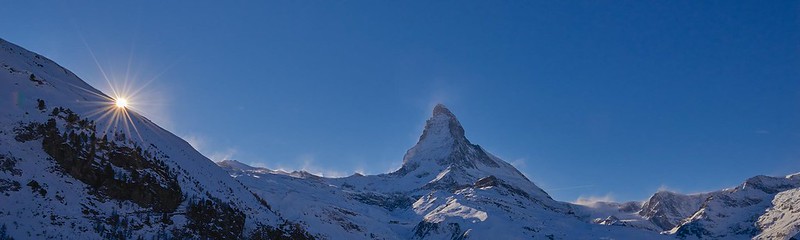
Mount Owen (12,928 feet (3,940 m)) is the second highest peak in the Teton Range, Grand Teton National Park in the U.S. state of Wyoming. The peak is named after William O. Owen, who organized the first documented ascent of the Grand Teton in 1898.

Mount Owen is part of the Cathedral Group of high Teton peaks, a collection of peaks in the central section of the range that are particularly rugged. The 40-mile (64 km) long Teton Range is the youngest mountain chain in the Rocky Mountains, and began its uplift 9 million years ago, during the Miocene. Several periods of glaciation have carved Mount Owen and the other peaks of the range into their current shapes. Valhalla Canyon is situated on the west slopes of Mount Owen.

Suuçtu Waterfalls , Mustafakemalpaşa , Bursa


Suuctu Waterfall is in the middle of a natural paradise, situated 18 km from Mustafakemalpasa and the roar of the water falling 38 meters is very pleasant.

It is a fascinating resort area to visit during the weekends especially for those from Istanbul and Balikesir, actually called as Suuctu and connected to a road for 13 km to Tumbuldek thermal waters.

Suuctu Waterfall is about 30 meters width in winter season, which may reach to 50 meters by reason of flood, also meet the drinking water requirements of the Mustafakemalpasa residents.

Suuctu Waterfall is a natural paradise surrounded by beech, oak and pine trees.

Mocona Falls , Argentina ,Brazil , Uruguay


Iguazu Falls may be the most popular waterfalls in Argentina, but Mocona Falls take the crown for the most unique. Mocona does not follow the normal downward and forward trajectory that most waterfalls do. Instead, it runs along the length of the river with water spilling off the side into a gorge. At 3 km long, it is perhaps the only waterfalls in the world to run parallel to the river rather than perpendicular.

Mocona Falls, also known as Yucumã Falls, is located in the Uruguay river, in the province of Misiones, in Argentina, 337 kilometers from the city of Posadas and 322 kilometers from Iguazu Falls. Since the Uruguay river acts as a natural border between Argentina and Brazil, this unique geological feature is shared by both countries. The name Moconá means “to swallow everything” in the Guarani language and is used mostly in Argentina. Yucumã means “the big fall” and is popular in Brazil.

An unusual feature of the Uruguay River is the presence of a submerged canyon or trench at the bottom of the river channel. The canyon, which is believed to have formed during the Ice Age, when the climate was drier and the river was narrower, is up to 100 meters deep and 15 - 30% of the width of the river. The canyon is only visible in two places, one of which is the Moconá Falls.

The falls itself are not visible for 150 days a year when the river is full. During this period, the falls become more like rapids. When water level becomes low and falls below the edge of the canyon, it starts spilling into the now exposed canyon, and the Mocona Falls is formed. Depending on the volume of the water dragged by the Uruguay River, the height of the falls varies from five to seven meters. The width of the waterfall is also subjected to water volume ranging between 1,800 meters and 3,000 meters wide.

The area where the Moconá falls are located is considered a Provincial Park which include the Yabotí Biosphere Reserve. Countless lodges have been settled down in the area which provide accommodation for visitors in search of water activities such as rubber boat rafting, canoe outings, kayaking and safaris along the river and creeks around this wetland.

Thjorsa , Iceland


Thjorsa, Iceland’s longest river, sources from the icelandic glacier Hofsjokull.
At 230 km (143 mi), it flows out through narrow gorges in the highlands of Iceland. Before it enters the lowlands, it meets the Tungnaa River before passing the valley of Thjorsardalur.

The river also has several small islets, the largest being Hagaey and Arnes, where from Arnessysla county takes its name.
At Arnes you can see the ruins of an ancient local parliament, Arnesthing.

Thjorsa also offers great opportunities for fishing in Iceland.
Thjorsa and its tributaries are among the most abundant salmon rivers in Iceland. Salmon, trout, tar, salmon trout, stickleback, eel and the European Flounder are all found in this popular river in Iceland.
Seals are also found in the river and have long been hunted there.

Kizilirmak , Corum


The Kızılırmak (Turkish for "Red River"), also known as the Halys River , is the longest river entirely within Turkey. It is a source of hydroelectric power and is not used for navigation.

The Kızılırmak flows for a total of 1,355 kilometres (842 mi),[2] rising in Eastern Anatolia around 39.8°N 38.3°E, flowing first to the west and southwest until 38.7°N 34.8°E, then forming a wide arch, the "Halys bend", flowing first to the west, then to the northwest, passing to the northeast of Lake Tuz, then to the north and northeast, where it is joined by its major tributary, the Delice River (also known by its Greek name Cappadox) at 40.47°N 34.14°E, and after zigzagging to the northwest to the confluence with the Devrez River at 41.10°N 34.42°E, and back to the northeast, joining the Gökırmak before finally flowing through its delta into the Black Sea at 41.72°N 35.95°E. Dams on the river include the Boyabat, Altınkaya and Derbent.

Hjelle, Norway


Hjelle lies at the eastern end of Lake Strynevatn, midway between Stryn Sommerskisenter (20 km) and Stryn township (27 km).  This is a peaceful spot surrounded by spectacular scenery, which has retained the atmosphere of Norwegian rural districts from days gone by. 

Jumbo Pass , Canada


Jumbo Pass, elevation 2270 m, is situated in the central Purcell Mountains of BC, between the headwaters of Jumbo Creek, flowing east into Toby Creek, which empties into Windermere Lake, and Glacier Creek which flows west to Duncan Lake. Lumber roads pass within 2 km of the pass in both drainages. There is no significant history attached to the pass, but it may have been used by Indians in days past, as there was at one time a rough trail over the pass. With the recent increase in popularity of mountaineering, hiking and skiing, improved trails now lead up to the pass from both sides, where a 4-man hut is located at the pass's north end.

Saturday, March 12, 2016

Santiago , Colina , Chile


Colina is a Chilean city and commune, capital of the Chacabuco Province, in the northern part of the Santiago Metropolitan Region.

Giresun , Turkey


Giresun  is the provincial capital of Giresun Province in the Black Sea Region of northeastern Turkey, about 175 km (109 mi) west of the city of Trabzon.

The surrounding region has a rich agriculture, growing most of Turkey's hazelnuts as well as walnuts, cherries, leather and timber, and the port of Giresun has long handled these products. The harbour was enlarged in the 1960s and the town is still a port and commercial centre for the surrounding districts, but Giresun is not large, basically one avenue of shops leading away from the port.

Like everywhere else on the Black Sea coast it rains (and often snows in winter) and is very humid throughout the year, with a lack of extreme temperatures both in summer and winter. As a result Giresun and the surrounding countryside is covered by luxuriant flora. As soon as you get beyond the city buildings you get into the hazelnut growing area and the high pastures (yayla) further in the mountains are gorgeous.

Thun , Switzerland


Thun is one of the most original towns in Switzerland. It occupies an admirable site within view of the Bernese Alps and is much overlooked by visitors pressing on to Interlaken. With its picturesque castle and quaint medieval center Thun (pronounced toon) is well worth a visit. Beautiful views of the Eiger, Mönch and Jungfrau and, closer at hand, the giant pyramidal Niesen (2362m) and flat-topped Stockhorn (2190m) are a gentle prelude to the Alpine vistas further south.

 Lovely Lake Thun and surrounding mountainsLake Thun is one of the loveliest and largest lakes in Switzerland and very much appreciated by tourists and locals alike. Located within green mountains and snowy summits (namely the Jungfrau) Lake Thun presents many opportunities for water-sports and swimming. A well documented network of walking path along the Lake and above the villages in the foothills invite for activities such as hiking and mountain biking.

Friday, March 11, 2016

Iguazu falls , Brazil


The exquisite Iguazu Falls are also known as the Iguassu Falls and the Iguaçu Falls. The magnificent spectacle of these 275 individual drops has awed tourists, locals and indigenous inhabitants for centuries. They originate from the Iguazu River and are located on the border of Brazil (in the state of Paraná) and Argentina.
In fact, the Iguazu Falls are what divides the river of the same name into its upper and lower portions, a fact that has given rise to several myths and legends as to their origin. This river forms the boundary between Brazil and Argentina, making it a significant part of the political and geographical structure of the continent of South America.


Uummannaq , Denmark


Uummannaq is a town in the Qaasuitsup municipality, in northwestern Greenland. With 1,282 inhabitants in 2013,it is the eleventh-largest town in Greenland, and is home to the country's most northerly ferry terminal. Founded in 1763 as Ûmañak, the town is a hunting and fishing base, with a canning factory and a marble quarry. In 1932 the Universal Greenland-Filmexpedition with director Arnold Fanck realized the film SOS Eisberg near Uummannaq.

Uummannaq is located 590 kilometres north of the Arctic Circle on Uummannaq Island located in the south-central arm of the Uummannaq Fjord. Uummannaq is also the general name given to the series of inlets north of the promontory at Niaqornat on the Nuussuaq Peninsula.

Thursday, March 10, 2016

Ikizdere , Rize , Turkey


İkizdere is a town and district of Rize Province in the Black Sea region of Turkey.

This is hilly countryside inland from the Black Sea, forest-covered steep mountainside separated by narrow valleys, with areas of high pasture. The İkizdere is formed from streams running out of the Rize Mountains and continues down to the Black Sea, it is dammed for hydro-electric power and for irrigation. There is snow on the high peaks and lots of glacial formation. The climate is typical of the Black Sea region i.e. it rains all the time. There is broad-leaf forest at lower elevations and pine higher up.

İkizdere is an agricultural district, growing tea on the hillsides and potatoes in the valley, and now some kiwi fruit are being planted also. Cattle and sheep are grazed on the hillsides, going up to the high pastures (yayla) in summer. Beekeeping is another important source of income, particularly in the village of Anzer. And this very attractive countryside is now attracting tourists, on trekking holidays. However on the whole İkizdere is not a wealthy region and the younger generations migrate to Turkey's larger cities in search of jobs.

The town of İkizdere is on the river bank, 56 km (35 mi) from the city of Rize on the road to Erzurum.

Mount Rainier National Park , USA


Mount Rainier National Park is a United States National Park located in southeast Pierce County and northeast Lewis County in Washington state. It was established on March 2, 1899 as the fifth national park in the United States. The park encompasses 236,381 acres (369.35 sq mi; 956.60 km2) including all of Mount Rainier, a 14,411-foot (4,392 m) stratovolcano.[4] The mountain rises abruptly from the surrounding land with elevations in the park ranging from 1,600 feet to over 14,000 feet (490 - 4,300 m). The highest point in the Cascade Range, around it are valleys, waterfalls, subalpine meadows, old-growth forest and more than 25 glaciers. The volcano is often shrouded in clouds that dump enormous amounts of rain and snow on the peak every year and hide it from the crowds that head to the park on weekends.

Mount Rainier is circled by the Wonderland Trail and is covered by several glaciers and snowfields totaling some 35 square miles (91 km2). Carbon Glacier is the largest glacier by volume in the contiguous United States, while Emmons Glacier is the largest glacier by area. About 1.8 million people visit Mount Rainier National Park each year. Mount Rainier is a popular peak for mountaineering with some 10,000 attempts per year with approximately 50% making it to the summit.

The park contains outstanding subalpine meadows and 91,000 acres (37,000 ha) of old growth forests.

Zlatibor , Serbia


Zlatibor  is a mountainous region situated in the western part of Serbia.

Zlatibor is an important tourist area of Serbia, with resources for health tourism, skiing and hiking.[1] The main city of the region is Užice, located at the foothills of the mountain, and most of the area belongs to the muicipality of Čajetina. Town of Zlatibor emerged from a group of vacation homes into a full-fledged urban location.

Zlatibor is administratively divided into two municipalities within Serbia: Čajetina and Užice, in the Zlatibor District. The railroad Belgrade-Bar passes through Zlatibor.