8:22 AM
Zara is a town and a district of Sivas Province of Turkey. The town is 70 km. (appr. 45 miles) away from Sivas down town.
8:20 AM
Lake Bogoria is a saline, alkaline lake that lies in a volcanic region in a half-graben basin south of Lake Baringo, Kenya, a little north of the equator. Lake Bogoria, like Lake Nakuru, Lake Elmenteita, and Lake Magadi further south in the Rift Valley, and Lake Logipi to the north, is home at times to one of the world's largest populations of lesser flamingos. The lake is a Ramsar site and Lake Bogoria National Reserve has been a protected National Reserve since November 29, 1973. Lake Bogoria is shallow (about 10 m depth), and is about 34 km long by 3.5 km wide, with a drainage basin of [[1 E8 m2|700 km2]].
Satellite image of Lake Bogoria taken from World Wind.
Local features include the Kesubo Swamp to the north and the Siracho Escarpment to the east, both within the National Reserve. The lake is also famous for geysers and hot springs along the bank of the lake and in the lake. In four locations around the lake can be observed at least 10 geysers, which erupt up to 5 m high. Geyser activity is affected by the fluctuations of lake level, which may inundate or expose some geysers.
The lake waters contain large concentrations of Na+, HCO3− and CO32− ions. They originate from inflow from the Sandai and Emsos rivers, and from about 200 alkaline hot springs that are present at three onshore sites: Loburu, Chemurkeu, and a southern group (Ng'wasis, Koibobei, Losaramat). Other springs discharge directly from the lake floor. Lake Bogoria also contains the highest concentration of true geysers in Africa (at least 18 are known). The lake waters are alkaline (pH:10.5) and saline (up to 100 g/L total dissolved salts). The lake has no surface outlet so the water becomes saline mainly through evaporation, which is high in this semi-arid region. The lake itself is meromictic (stratified) with less dense surface waters lying on a denser more saline bottom waters. Although hypersaline, the lake is highly productive with abundant cyanobacteria (Arthrospira fusiformis) that feed the flamingoes, but few other organisms inhabit the lake e.g. the monogonont rotifer species Brachionus sp. Austria (belonging to the Brachionus plicatilis cryptic species complex) is found in high densities.
The lake has not always been saline. Sediment cores from the lake floor have shown that freshwater conditions existed for several periods during the past 10,000 years, and that lake level was up to about 9 m higher than its present level of about 990 m above sea-level. At times it might have overflowed northward towards Lake Baringo. At times, during the late Pleistocene it might have been united with a larger precursor of modern Lake Baringo, but this is still uncertain.
The lake area was the traditional home of the Endorois people, who were forced to leave the area in the 1970s and are now challenging their removal at the African Commission on Human and Peoples' Rights.
8:18 AM
The Gorges Du Verdon (in French: Les Gorges du Verdon or Grand canyon du Verdon), in south-eastern France (Alpes-de-Haute-Provence), is a river canyon that is often considered to be one of Europe's most beautiful. It is about 25 kilometres long and up to 700 metres deep. It was formed by the Verdon River, which is named for its startling turquoise-green colour, one of the location's distinguishing characteristics. The most impressive part lies between the towns of Castellane and Moustiers-Sainte-Marie, where the river has cut a ravine to a depth of 700 metres through the limestone mass. At the end of the canyon, the Verdon River flows into the artificial lake of Sainte-Croix-du-Verdon (in French: Lac de Sainte-Croix).
Because of its proximity to the French Riviera, the gorge is very popular with tourists, who can drive around its rim, rent kayaks to travel on the river, or hike. The limestone walls, which are several hundreds of metres high, attract many rock climbers. It is considered an outstanding destination for multi-pitch climbing. The variety of 1,500 routes encompass cracks, pillars and seemingly endless walls, and range in distance from 20m to over 400m. The climbing is generally of a technical nature.
8:16 AM
Mount Hasan (Turkish: Hasan Dağı) is an inactive stratovolcano in Aksaray province, Turkey. With an elevation of 3,268 m (10,722 ft), it ranks as the second highest mountain of central Anatolia. A caldera 4-5 kilometres wide formed near the current summit around 7500 BC, in an eruption recorded in Neolithic paintings.
The ancient settlement of Çatalhöyük collected obsidian from the area of Hasan Dağ, which they probably traded with other settlements for luxury goods. Obsidian mirrors and flakes have also been found. The importance of Hasan Dağ to the people of Çatalhöyük may be shown by a wall painting, sometimes called the "first landscape" by art historians, which some believe is a depiction of Hasan Dağ towering over the settlement's houses.
It was the second mountain from the south in the Byzantine beacon system used to warn the Byzantine capital of Constantinople of incursions during the Arab–Byzantine wars.
Approximately a six hours' walk is required to climb to the top of the mountain from the highest point accessible by car. The summit offers a fabulous view over the central Anatolian plateau, including distant Cappadocia.
8:13 AM
Broc is a municipality in the district of Gruyère in the canton of Fribourg in Switzerland.
8:10 AM
Silifke is a town and district in south-central Mersin Province, Turkey, 80 km (50 mi) west of the city of Mersin, on the west end of Çukurova.
Silifke is near the Mediterranean coast, on the banks of the Göksu River, which flows from the nearby Taurus Mountains, surrounded by attractive countryside along the river banks.
8:01 AM
The Elephant Foot Glacier in northeastern Greenland, looks like a bowl of batter that has been poured over a pan. The sheer pressure of the zillion-ton ice has broken through the mountain and spilled into the sea in a near symmetric, fan-shaped lobe. Such glaciers are known as piedmont glaciers, and the Elephant Foot Glacier is a perfect example of it. Its shape is so distinct that it stands out dramatically from its surroundings when viewed from high above.
Glaciers are one of the most extraordinary of the earth’s natural phenomena. These rivers of frozen snow accumulated over centuries of precipitation are so densely packed that it exceeds its overall ablation. They are in a constant state of flux, flowing down in the direction of the slope towards a valley or a water body. You can’t really tell if it’s moving but come back in a few decades and you will be able to see the dramatic change in the landscape.
The Elephant Foot Glacier is located on the Kronprins Christian Land peninsula. It is not connected to Greenland’s main ice sheet. Rather, it’s part of a network of glaciers and ice caps that hangs around the periphery of the island. Research has shown that as a whole, these outlying glaciers and ice caps account for 5 to 7 percent of Greenland’s total ice coverage, but they are responsible for 20 percent of its contribution to sea level rise.
7:57 AM
The ice-clad Alpamayo Peak (19,511ft / 5947m) is part of the Cordillera Blanca mountain range in the Peruvian Andes. It’s a steep mountain, famous for its almost perfect pyramidal structure and beautiful top cone. Remotely located, the ascent should only be attempted by experienced mountaineers with proper climbing equipment. Literally translated from Quechua, Alpamayo means ‘Earth River’. In 1966, it came first in a survey amongst climbers and photographers, winning the title of ‘most beautiful mountain in the world’.
7:51 AM

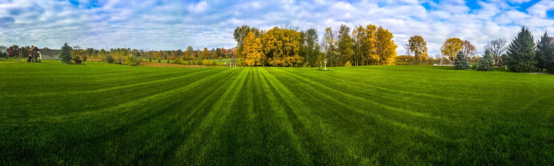
Beavercreek is the largest city in Greene County, Ohio, United States, and is the second largest suburb of Dayton behind Kettering. The population was 45,193 at the 2010 census. It is part of the Dayton Metropolitan Statistical Area. The Beavercreek area was settled in the early 1800s. A part of Beavercreek Township was incorporated and became the City of Beavercreek in February 1980. The township includes the area known as Trebein. The city boasts two golf courses, Beavercreek Golf Club (Public) and The Country Club of the North (Private). Many Beavercreek residents work on the nearby Wright-Patterson Air Force Base. The Mall at Fairfield Commons and The Greene Town Center are two malls in the city. In terms of number of residents in an incorporated area, Beavercreek is third in the region behind Dayton and Kettering. In 2007, Beavercreek ranked 84th in Money's Top 100 places to live. General Janet C. Wolfenbarger, former Vice Commander, Air Force Material Command and highest-ranking woman in the United States Air Force (as of 1 January 2010), hails from Beavercreek and is 1976 graduate of Beavercreek High School.
7:29 AM
Dynjandi (also known as Fjallfoss) is a series of waterfalls located in the Westfjords (Vestfirðir), Iceland. The waterfalls (7 total) have a cumulative height of 100 metres (330 ft) and are truly one of the most beautiful cascading waterfalls in Iceland.
7:24 AM
Los Caracoles Pass (or “Snails Pass”) is located in a remote section of the Andes Mountains on the Chilean side of the border with Argentina. The twisting road climbs to an elevation of 10,419 feet, has no roadside safety barriers, and is frequented by large trucks.
7:57 AM
Bolzano is the capital city of the province of South Tyrol in northern Italy. With a population of 105,713 (2013), Bolzano is also by far the largest city in South Tyrol.
Bolzano is the seat of the Free University of Bozen-Bolzano, where lectures and seminars are held in English, German and Italian. The city is also home to the Italian Army's Alpini High Command (COMALP) and some of its combat and support units.
In 2014 version of the annual ranking of quality of life in Italian cities, Bolzano was ranked as having the 1st Best Quality of Life in Italy.
Along with other Alpine towns in South Tyrol, Bolzano engages in the Alpine Town of the Year Association for the implementation of the Alpine Convention. The Convention aims to promote and achieve sustainable development in the Alpine Arc. Consequently, Bolzano was awarded Alpine Town of the Year 2009.
7:55 AM
Issyk-Kul Region is one of the regions of Kyrgyzstan. Its capital is Karakol. It is surrounded by Almaty Region, Kazakhstan (north), Chuy Region (west), Naryn Region (southwest) and Xinjiang, China (southeast). It takes its name from Lake Issyk-Kul ("warm lake"), the second largest saline lake in the world, which never freezes despite its altitude in the Tian Shan mountains.
The north is dominated by the eye-shaped Issyk-Kul lake, surrounded by the ridges of the Tian Shan mountain system: the Kyungey Ala-Too mountains to the north and the Terskey Alatau to the south (the 'sunny' and 'shady' Alatau, respectively). To the south is mountains and 'jailoos' (mountain meadows used for summer grazing). The highest peaks of the Tian Shan mountains, including Khan Tengri, are located in the easternmost part of the province.
Most of the population of the province lives around the lake, in particular in the cities of Balykchy near the lake's western end, and Karakol near its eastern end.
7:53 AM
The Merced River , in the central part of the U.S. state of California, is a 145-mile (233 km)-long[1] tributary of the San Joaquin River flowing from the Sierra Nevada into the San Joaquin Valley. It is most well known for its swift and steep course through the southern part of Yosemite National Park, and the world-famous Yosemite Valley. The river's character changes dramatically once it reaches the foothills and the lowlands, becoming a slow-moving waterway meandering through irrigated fields.
When tectonic activity first led to the uplift of the Sierra, the river formed as a steep stream eroding into the range's western flank, carrying sediments that would later help form the floor of the Central Valley. A rich riparian zone around the Merced once supported millions of migratory birds along the Pacific Flyway, and the river had one of the southernmost runs of salmon in North America. Indigenous people, including the Miwok and Paiute tribes, lived along the river for thousands of years, thriving on the bountiful flora and fauna supported by the river and its diverse lower course, aided by fertile soils eroded from the mountains.
Military expeditions during the Mexican Era history of California passed through the Merced River region in the early 19th century. The California Gold Rush brought many people into California and some settled leading to the establishment of a railroad along the river, bringing minerals and lumber to towns that had been established on the lower Merced, and later provided tourism to the now-national park area. Conflicts between whites and indigenous peoples prompted wars, resulting in the expulsion of the Ahwahnechee from Yosemite Valley. In the 20th century, the river saw further development that would change its state forever.
Large-scale irrigated agriculture was introduced to the Central Valley in the late 19th century, and led to the construction of numerous state, federal and privately owned dams. Water demand has often been higher than the river's environment can sustain. Salmon have been blocked from migrating and riverside habitat has declined dramatically. Recent years have seen habitat conservation work, mimicking of historic streamflow patterns, and the establishment of a salmon hatchery, in the hopes that the river's health can be protected from further damage.
11:39 AM
The Hundred Islands National Park (Pangasinan: Kapulo-puloan or Taytay-Bakes) is a national park in the Philippines. The protected area is located in the city of Alaminos, in the province of Pangasinan in northern Philippines. The islands, totaling 124 at low tide and 123 at high tide, are scattered in Lingayen Gulf covering an area of 16.76 square kilometres (6.47 sq mi). Only three of them have been developed for tourism: Governor Island, Quezon Island, and Children's Island. The Lucap wharf in Alaminos, the entrance to the National Park, is about 240 kilometres (150 mi) north of Manila, the capital of the Philippines.